GeoVestigations
NOTE: THIS PROJECT MEETS ALL OF THE AMES DSLR's: (1) CRITICAL THINKING; (2) EFFECTIVE COMMUNICATION, and (3) INTEGRATION OF KNOWLEDGE AND SKILLS.
REGIONAL ISSUES for US and CANADA:
Agriculture, Food Supply, and World Hunger Geographic Inquiry Process Steps
|

What is a Geographic Question?•
| ||||||

|
Step 2 - Acquire the geographic information needed to answer such questions.
Numerous maps, atlases, and other resources are available in the classroom. Online sources are also provided on this website. You should also know that it is unlikely you will find the complete answer in a single place where you can simply copy it down. Formulating the answer will take a little detective work, thinking, and the use of several sources. Your job in this stage is to take notes and collect facts that could be useful to your question. You are responsible for citing all sources used. You may use either MLA or APA format. Citation Machine makes this easy. If you have questions ask for assistance. It is also important to think about the RELIABILITY of the source. How trustworthy is this source? Step 3 - Arrange the geographic information you have found: This MUST include a MAP. Other geographic representations include charts, graphs, pictures, graphic organizer, etc. Anything that will help you explain to others what you have found. |
Resources:
Here are a few links to get you started, but don't forget the great print resources including maps, atlases, class text, and reference books. EBSCO, World Book Online and others located off the Pioneer Library. Data Finder - search, sort, graph, and map various population indicators. http://www.infoplease.com/ Google Maps http://www.about.com http://www.indexmundi.com/ http://www.howstuffworks.com/ http://geology.com/ http://www.enchantedlearning.com/ http://nationalmap.gov/ http://memory.loc.gov/ammem/index.html http://www.census.gov/ http://www.fedstats.gov/mapstats/thememaps/ http://zipatlas.com/ WORLD POPULATION and ME - view interactive POPULATION PYRAMIDS and population growth and decline for various regions based on your current age. Remember to cite all sources! Here is a link directly to Citation Machine |
|
Step 4 - Analyze the geographic information for the answers you are investigating.
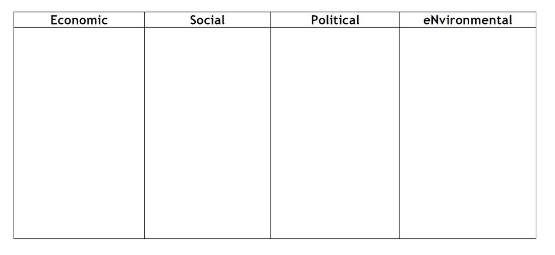
Put your facts together to answer the question. If you aren’t 100% sure of the answer that is OK, draw the most likely conclusion given the facts. Use these facts to support your answer when you explain your findings to others. Are there still holes in the information? What additional questions do you have? If you have tried to find information that will answer your question and are unable to come to conclusion with the notes that you have taken, organize your notes into the most interesting facts and determine what questions may have been answered by those facts. Use the ESPN Framework below to analyze and organize your thinking: |
|
|
Step 5 - Answer the geographic questions you asked at the beginning - Share with others
Answer your geographic question(s) and compile the information in a form that can be shared with others. Be prepared to share your findings in class. You will be assessed using the following rubric. SOURCE |
You can use this file and type your answers directly on this document. It makes it very easy to save to your portfolio.
| ||

INFORMATION BELOW TO BE USED LATER ON IN THE YEAR.
Overview
You will be investigating a global issue
|
Ideas:
|

|

|
Step #1:
Decide on your GLOBAL ISSUE. Read about the issue on the United Nations site.
|
Step #2:
Conduct your RESEARCH and complete the RESOURCE SHEET
|
Step #3
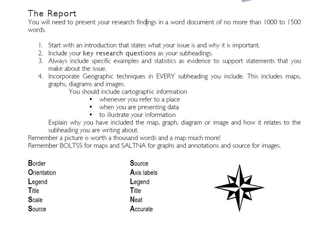
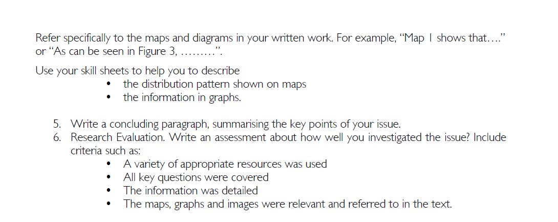
Write the REPORT - see guidelines below
|
Step #4:
Use your research report to develop your PRODUCT - something visual to share what you have learned with others.
|
Step #5:
Present on GLOBAL ISSUES AWARENESS DAY.
| ||
Resources:
|
| ||||
|
|
